

Republic of Altai · Chemal district
Land plot summary
The high-plot katun under the hotel, boat marina, start of rafting and water excursions in the direction of Kuyus, Beltertyuk, Sumulta and Ursula.
Chemal District
Chemal district of the Republic of Altai
document-specific
80,000 RUB per sotka
51.056219129,86.208416329
H-80!
04:05:090102:146
Key features of the site
- Scale: The area is specified by documents; the key value of the site is the high coast of Katun and the tourist scenario of the water base.
- Strong qualities of a place: proximity to water, forest environment, species potential, privacy, communication with recognizable tourist points.
- Purchase potential: glamping or chamber natural settlement; hotel facility, recreation center or service point for tourists; investment with the expectation of growth of tourist demand and land value; development cluster or land area for the project; roadside service, cafe, rental or service point of the route.
- Point of attraction: Kuyus; Beltertuyuk.
Detailed description of the site
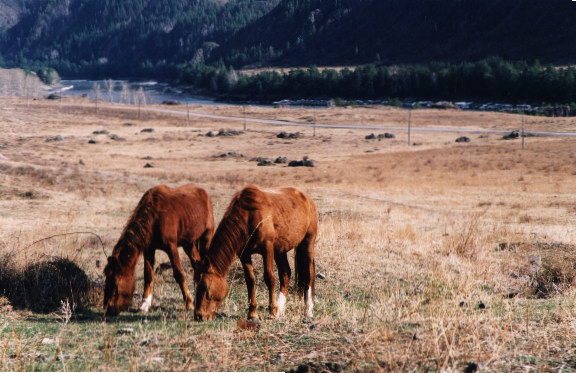
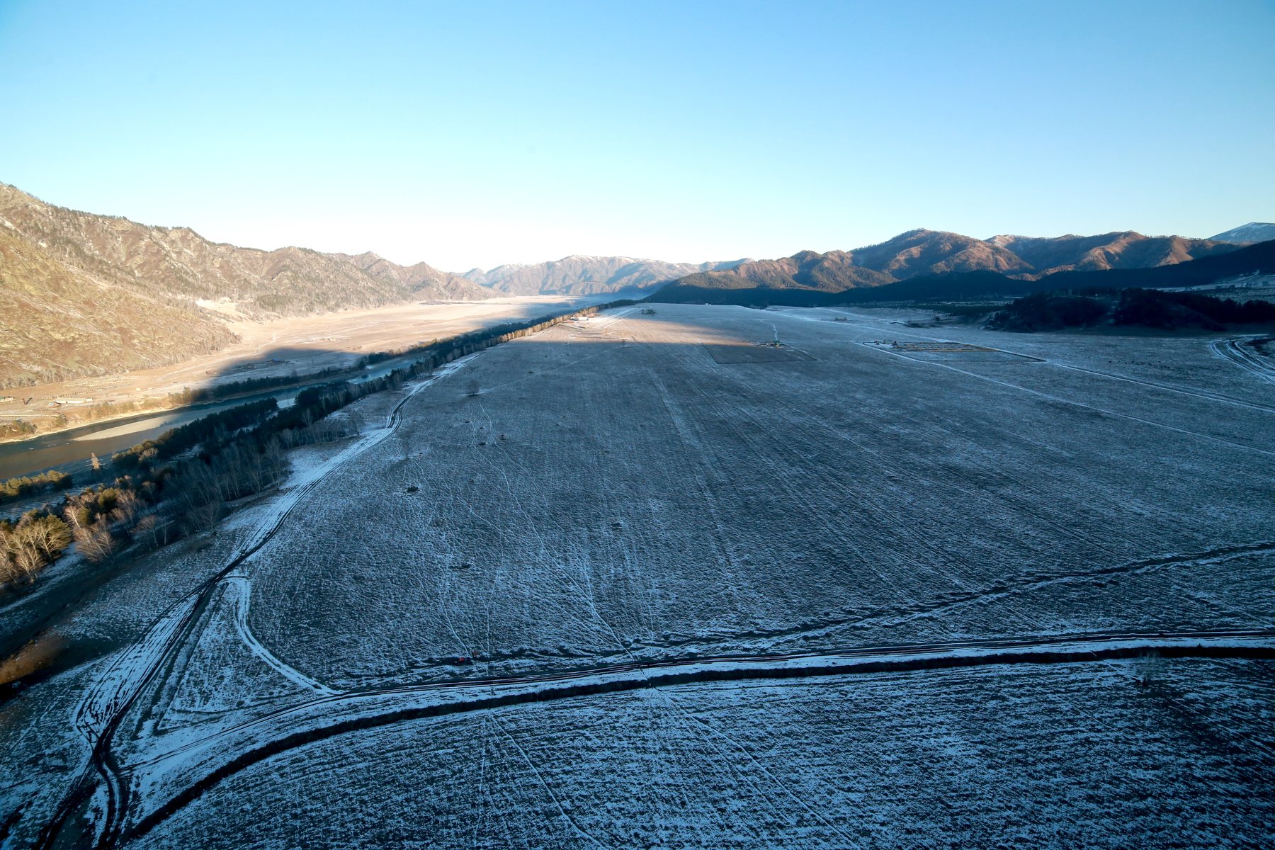
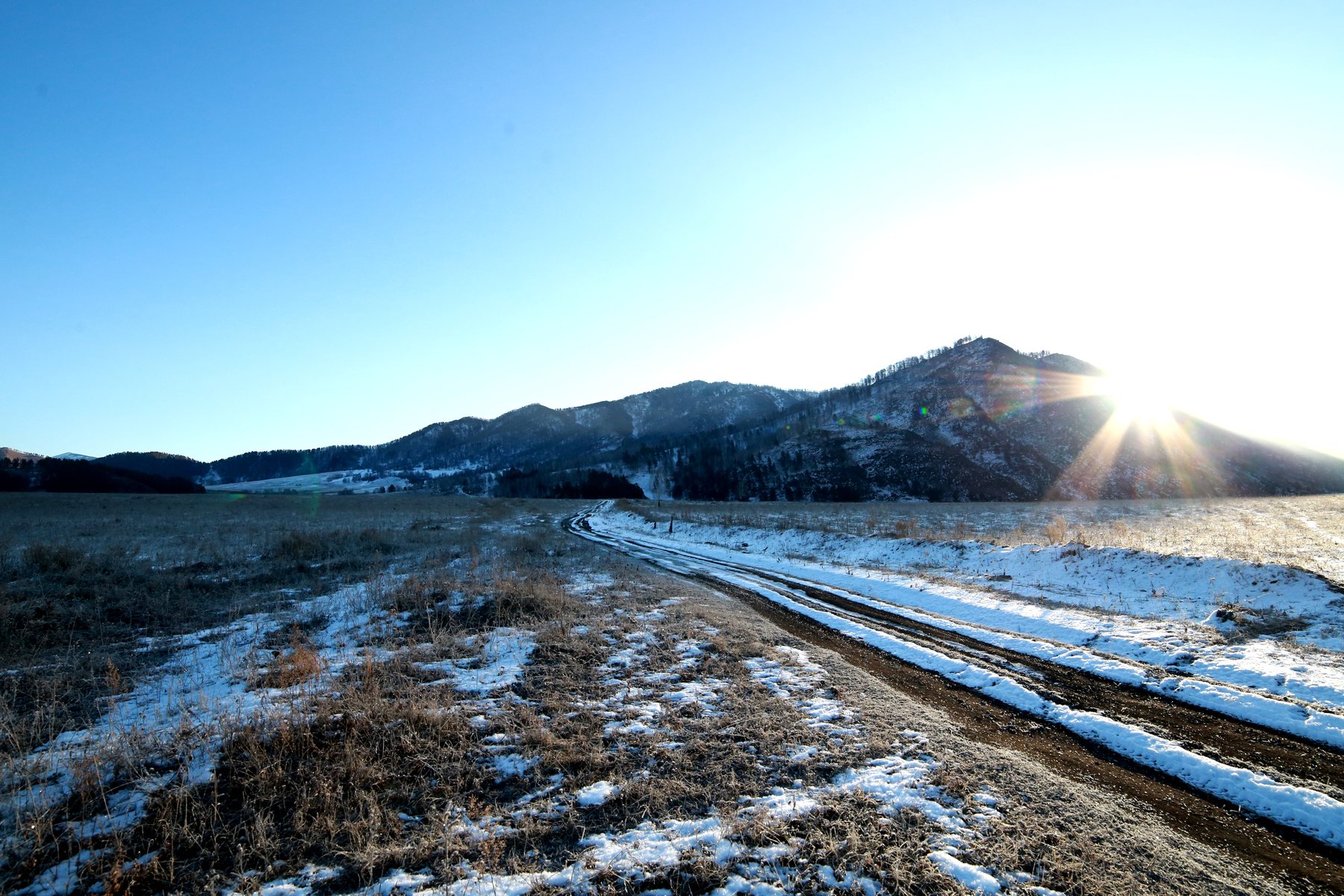
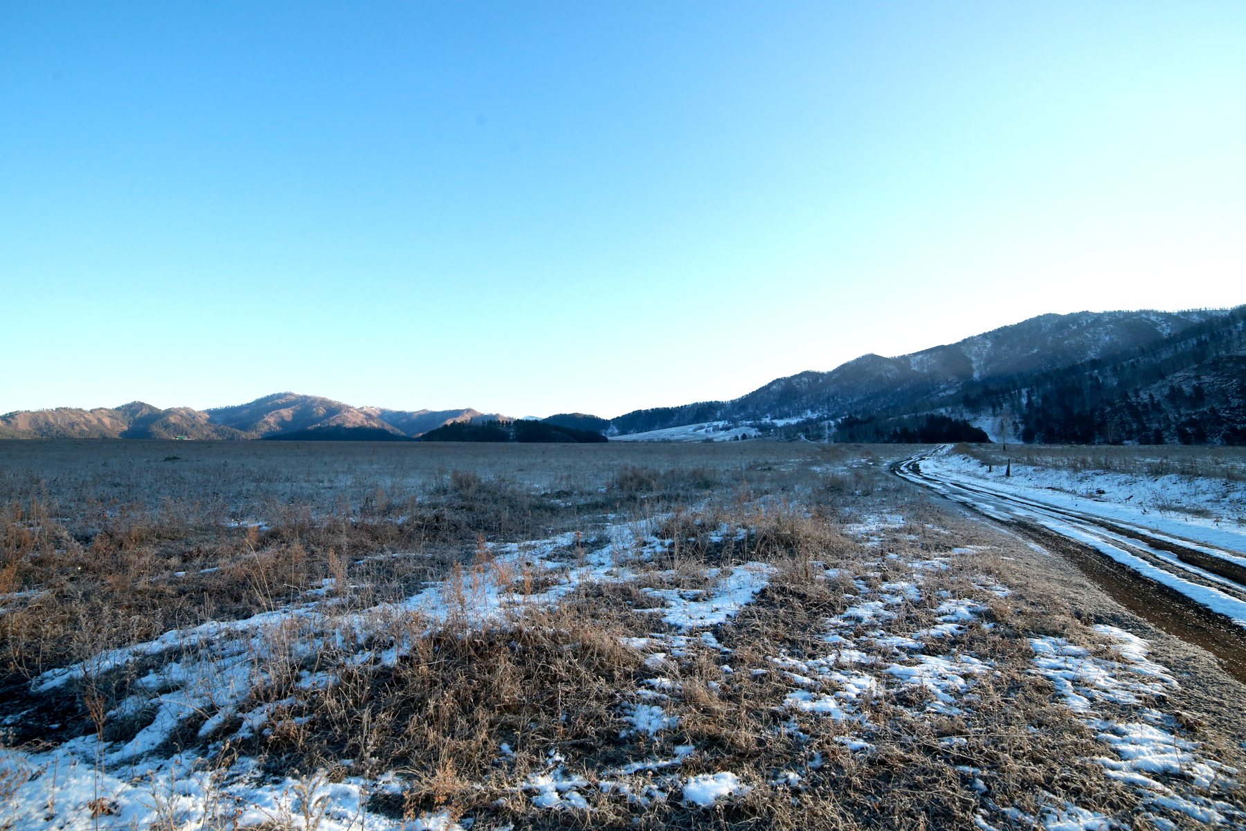
The land plot is located in the Chemal district of the Altai Republic, behind the village of Yelanda, on the high bank. katunThe road to Kuyus village is close to the site itself, with the electric poles on the site, making the site particularly interesting for creating a tourist complex with water and hotel functions.
This place should work as an entrance to the natural Katun outside the congested tourist center, where you can collect water excursions up the river, run alloys, receive tourists from the glamping city of Scythian Valley, the village of Waterfall, objects near the city. chebaHotel complexes of the Chemal district and other resort projects of the Altai Mountains.
The site is on a high katun It has a natural terrain that you can use in design logic, and it's a ravine that runs through the site, and you can think of the inner road that runs down the ravine from the driveway to the Katun shore, and it's an important advantage that the ravine can become a natural corridor to the water, not a problem.
The proper service is the hotel and marina on Katun for water excursions and active tourism, and it sells not just coastal land, but the opportunity to create a rare product: a starting point for routes along one of the strongest rivers in Altai.
Why the area fits under the water pier
The site has several signs of such a point: the road is approaching the territory, the electric line is on the site, there is a road. high-bankThere is a ravine as a potential transport corridor to the water, there are rocky protrusions under species and service zones, the direction to Kuyus and Beltertyuk waterfall passes nearby.
If you design a site properly, it can become not just a rafting start, but a full-fledged water and tourist hub, and the guest arrives, leaves the car, gets instructed, changes clothes, goes to the pier, goes out in a catamaran, a raft or a motor boat, returns to the base, eats dinner, stays overnight or goes further along the route.
Excursion program "Wild Katun"
This program might be called Wild Katun, and it's not supposed to be built as a box-like alloy, but as a water trip towards Kuyus, the waterfall. BeltertuyukThe image of the tourist is strong: not just a ride on the river, but to see the Katun that you can't feel from the hotel window or from the parking lot at a popular attraction.
The main idea of the route is to show the tourist another Altai, not noisy, not roadside, not built up with bases, but water, rocky, wide, wild and hard to access. In this part of Katun, the sense of space changes: less random people, less construction, more river, stone, forest, animal places, fishing stories, narrow banks, tributaries and real natural depth.
For a future marina, this is a key advantage. Most hotels and glampings sell accommodation. But living without a strong program quickly becomes a regular overnight stay. The water and route center sells the event. The guest comes not only to spend the night, but to go out on the water, see Katun from a different angle, walk the route, come back with emotion, have dinner, stay for the night and tell others about it.
Short route: pier - Kuyus - Beltertyuk
The basic program can go from the pier behind Yelanda up Katun towards Kuyusa and the waterfall. BeltertuyukIt is a clear and beautiful route for the general tourist: the river, rocky banks, views, stops for photos, a story about old trails, Kuyusa, Oroktoi direction and waterfall.
Waterfall Beltertuyuk It's a strong sightseeing anchor, located behind Kuyus village, and it's already known to tourists as a natural point at the far end of the Chemal direction, and if you connect it to the water program, you get not just a trip along the road, but a route with character: along Katun, to the waterfall, through a wilder space, with a return to the pier, dinner, bath or overnight.
Such a route can work as a day program for guests of the nearest bases, glampings, "Scythian Valley", the village of Waterfall, facilities near Cheba and hotels of the Chemal district.
Long route: wild Katun and Sumulta
A stronger and more expensive product is a long water excursion to the sparsely populated areas of Katun and its tributaries, including the Lower and Upper Sumulta, which is no longer a mass walk, but a route for people who want to see the real Altai outside the standard sightseeing showcase.
According to your data, this is one of the wildest parts of Katun, where there are no settlements, no dense buildings and almost no accidental ones. touristic. In places like this, you're more likely to find traces of a beast, a maral, or a bear than you are to find a human, and that's what you should sell as value: a rare sense of the wild Altai, where you can't just drive up in a car and take a picture from the parking lot.
Sumulta reinforces the route. It's a clear mountain river, the right tributary of Katun, known among fishermen as a strong place for the harius. It has cold clear water, rocky banks, fast flow and a completely different nature. It's not a "excursion" for the tourist, but a real immersion in natural territory.
The site card should present this program as a promising destination for premium water tourism. The buyer of the site should see not only the land, but also the future route product: the marina, hotel, boats, instructors, food, overnight stay, bath, long-distance water, wild Katun and partner rides from other sites.
Route to the mouth of Ursula
A separate strong line is the water program towards the mouth of the Ursul River, known as the confluence point of Ursula and Katuni, and also as the territory of the complex.Altai farmsteadIt's better to present it as a recognizable reference point and a high-class natural place, because if you choose to have closed residences and large departmental complexes, then the natural value of the valley is obvious.
For a tourist, the route to the mouth of Ursula may be interesting not because of someone else's closed territory, but because of the water itself: Katun, mountains, the mouth of a large tributary, natural views, the feeling of exit to a rarer and sparsely populated part of Altai, which can be a separate excursion for guests who need a deeper route rather than a standard set of Chemal-Patmos-Orokta.
Why does the market need such a program?
Water excursions are especially important because Katun is not fully understood from the shore, and from the road, the tourist sees the fragments of the river, from the water he sees it differently: currents, rocks, turns, tributaries, beaches, gorges, places without roads, wild banks and the real power of the river, an experience that is remembered more than a regular sightseeing trip.
If the marina works with the glamping city of Scythian Valley, the village of Waterfall, the sites near Cheba, the hotels of the Chemal district and future resort facilities, it can become a common water infrastructure for the entire direction. It is not one site. It is a route hub.
What a guided tour product might look like
The first level is short water walks along Katun for family tourists, hotel guests and those who want a beautiful excursion without complex preparation, these are the views on the water, photos, a story about Katun, the rocks, the Kuyus direction and the history of the place.
The third level is the long-distance program Wild Katun and Sumulta, which is a route for a more trained tourist who is interested in sparsely populated places, fishing, natural shores, tributaries, the absence of settlements, the taiga character and the sense of expedition.
Level four is the route to the mouth of Ursula, a species-based water tour to the famous natural confluence of Ursula and Katun, with a story about the valley, climate, closed residences, the natural choice of place and the special character of this part of Altai.
Level five is a partnership program for glamping and hotels, and the marina can host guests from different venues and sell them ready-made water packages: morning route, evening walk, family excursion, fishing, corporate departure, photo tour, winter program in conjunction with a bath and snowmobiles.
Beltertyuk Falls as a Route Anchor
Waterfall Beltertuyuk This is one of the points that reinforces the commercial logic of the marina, which is a natural landmark outside Kuyus village that tourists who come to the far side of the Chemal destination already know, but when it comes to the water program, it gets a different level of perception.
You don't have to sell the tourist an abstract "river walk." You have to sell the clear route: Katun, high banks, rocks, waterfalls, stops, photos, wildlife, return to base, dinner and overnight stay, and you form a product with a normal price, understandable duration and repeatable operating model.
Hotel and service unit
An important principle is that the hotel should not be an independent "sleephouse by the road", but part of the route system, then it is sold not through random demand, but through programs: water excursion, rafting, overnight stay, bath, meals, winter tour, corporate arrival, photo route.
Winter use model
In winter, water activity decreases, but the site should not stand idle. It can be used as a base for winter programs: snowmobiles, mountain bikes, ATVs, species routes, baths, winter photo tours, short expeditions, corporate trips, family winter races.
Partnering with other objects
A water marina can operate not only for its own hotel, but also in its partner network, it can receive guests from the glamping city of Scythian Valley, the village of Waterfall, objects near the glamping city of Scythian Valley, the village of Waterfall, and the facilities near the waterfront. chebaHotels of the Chemal district, recreation centers on Katun, apart-complexes and future resort projects.
This is an important argument for the investor: the marina receives an external flow, and partner facilities receive a ready-made excursion program, and the market lacks well-organized natural excursions, especially water excursions, where there is not only a boat, but also understandable infrastructure: parking, service, food, waiting, photos, briefings and a program.
Such a facility could become a common route point for several resort areas, and that's the capitalization: it doesn't depend on its own load, but rather acts as an infrastructure hub for the entire destination.
Investment logic
The project economy can consist of several sources: hotel rooms, water excursions, alloys, equipment rental, rental of catamarans and rafts, motor boats, instructor services, transfer, parking, restaurant, bath, winter tours, snowmobiles, quad bikes, corporate programs, partner commissions from recreation centers and the sale of package routes.
The second stage is a specific hotel, restaurant, bath, permanent pier, expansion of the water park of equipment, partner routes and winter equipment.
The third stage is a full-fledged route center with a year-round program, a first aid office, corporate tours, expedition routes and a link with other resort facilities.
Why does it increase the cost of the site
The marina is not only valuable because it's by the water, but the Altai has many beautiful beaches, but not every shore can become a functioning infrastructure. high-bankThe ravine as a natural corridor to the water, places for hotel and service block, view hills and route logic up Katun.
The main formula of the project: katun And it's the marina plus the routes plus the hotel plus the partner network, and it's this bunch that turns the site into an infrastructure asset.
Who's the site fit?
The site is suitable for an investor who wants to create not an ordinary recreation center, but a water-route center on Katun.
It is suitable for an alloy operator who needs its own shore point, hotel, warehouse, parking, instruction area and base for tourist groups.
It is suitable for a developer who understands that Altai lacks not only accommodation, but also quality route products.
It is suitable for a partner in active tourism: rafting, catamarans, motor boats, winter routes, quad bikes, snowmobiles, corporate programs and excursions.
It is suitable for owners of glampings and hotels as a partner infrastructure through which you can expand the program of guests’ stay.
Practical conclusion
The site behind the village of Jelanda is a rare coastal site for the creation of a water-route center on Katun, its strength is the combination of the road, the high shore, the electric line on the site, the ravine as a natural corridor to the water, the rocky terrain, the panoramic views and the ability to organize the marina, alloys, water excursions, hotel and winter activities.
Here you can create one of the strong route points of the Chemal direction: the start of alloys, water excursions to Kuyus and Beltertyuk, a base for distant natural routes, a hotel for active tourists, service-centre for partner glampings and year-round playground of active recreation.
The idea is simple: not only does a tourist lack a nice room, he needs a strong route, and this section can be the place where the route begins.
What might be interesting to the buyer
It is not only the land itself that is important, but also the combination of location, use case and future capitalization.
- Format: glamping or a chambered natural settlement.
- Tourism: hotel facility, recreation center or service point for tourists.
- Economics: capital investment with the expectation of growth of tourist demand and land value.
- Scale: development cluster or land mass for the project.
- Service: Roadside service, cafe, rental or service point of the route.
- Economics: A clear price in the card helps quickly estimate the project economics: 80,000 RUB per sotka.
What to check before purchase
- Access, condition of the road and seasonality of access.
- Electricity, water, communications and connection points.
- the boundaries of the site, the actual relief and the neighboring surroundings.
- restrictions on land category, IRI, protected areas and fire requirements.
|
Recommended appointment
? Categories/Usage scenarios |
Forest plots, Arrays for investors and developers, Hard-to-reach areas, Sites for capitalization - undervalued areas with high growth potential, Glamping plots, Sites for hotels and recreation centers, Sites for roadside business, Sites with panoramic views, Sites near rivers and lakes |
|
District
? District |
Chemal District |
|
Location type
|
In the forest, Panoramic view, Hard access, By the water, By the river, Secluded location |
|
Pond/river/lake
|
Katun, Cheba |
|
Price per hundred
|
80000 |
|
Attraction
|
Kuyus, Beltertuyuk |
|
Large array
|
No. |